


f38880_autrans_la_buffe_gl_lcv_n2

ageo
User

Length
17.6 km

Max alt
1634 m

Uphill gradient
865 m
Km-Effort
29 km

Min alt
1294 m

Downhill gradient
865 m
Boucle
Yes
Creation date :
2017-07-07 00:00:00.0
Updated on :
2017-07-07 00:00:00.0
5h47
Difficulty : Medium

FREE GPS app for hiking
 SityTrail
IGN / Geographical institutes
SityTrail Plus
The world is yours!
About
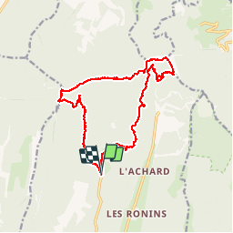
Trail Walking of 17.6 km to be discovered at Auvergne-Rhône-Alpes, Isère, Autrans-Méaudre en Vercors. This trail is proposed by ageo.


Positioning
Country:
France
Region :
Auvergne-Rhône-Alpes
Department/Province :
Isère
Municipality :
Autrans-Méaudre en Vercors
Location:
Autrans
Start:(Dec)
Start:(UTM)
701010 ; 5009831 (31T) N.
Comments